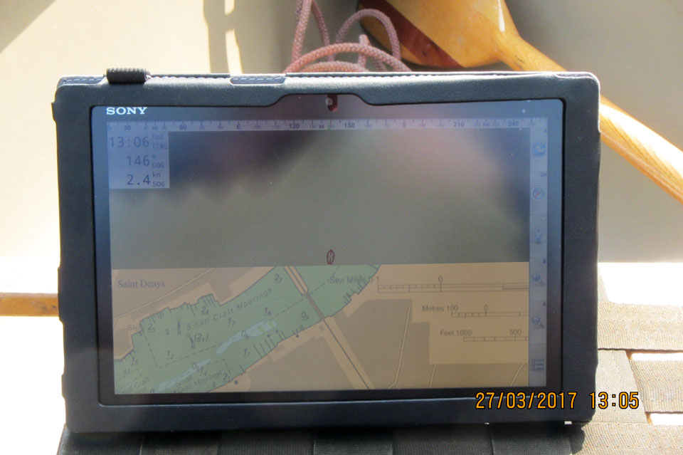
 It promised to be a nice day, if a little misty at first, so I decided to motor in SeaOsprey down the Itchen towards the docks. Before Christmas I had bought a refurbished Sony xperia tablet from "Visit my Harbour" which came loaded with Admiralty charts and I thought I'd try it out by identifying and photographing the various old wharves along the east side of the river. Unlike my iPad the xperia is supposed to be water resistant so suitable for using in the canoe - provided I don't capsize!
To some extent the tablet was a disappointment - I don't know how people manage to see the screen to navigate when it is sunny. However it will do as a backup for my Garmin chartplotter in Seatern and it provides a bit of fun for canoe trips!
Photo Albums from the trip:
-
[Drivers Wharf to Dibles Wharf] - East side of the Itchen going downstream from Northam Bridge: Drivers Dry Stack, scrap metal on Princes Wharf, Saxon Wharf (inc. Oyster Yachts), Oil Spill response on Millstone Point, Shamrock Quay Marina, Bakers Wharf, Ocean Quay Marina (Elliots Wharf, James Wharf) and Dibles Wharf.
-
[Ballast Wharves to Crosshouse Hard] - several wharves near the new St. Mary's Stadium are used for dredged agregates and ballast: Belvidere and Crown, Leamouth, Britannia, Phoenix, Burnley, and Sunderland. American Wharf is home to a mini-marina, while a new riverside development is planned for Chapel Wharf and Corporation Wharf. Crosshouse Hard was the eastern terminus of the Itchen Ferry service to Itchen Ferry Village. The ferry was replaced by the Floating Bridge which in turn was replaced by the high level Itchen Bridge. The ancient "crosshouse" was designed to provide shelter to waiting ferry passengers no matter which way the wind was blowing.
-
[Crosshouse Hard to Ocean Village, then Woolston] - while the Itchen ferry ran from Crosshouse Hard, the Floating Bridge, which replaced it, ran from the hard which is now part of the Southampton Water Activities Centre, just south of the Itchen Bridge... which replaced the Floating Bridge. Ocean Village and its Marina occupy the "Open Dock" which, with the "Close Dock" were the original Southampton Docks in Victorian Times. The Close Dock was filled in, presumably when the Eastern Docks complex was built. A dredger looked to be coming in and a hovercraft had contacted VTS prior to coming out so I gave up going along the eastern side of the Itchen and crossed to the Woolston side. There the development of the Vosper-Thorneycroft ship building site dominates the shore line.
-
[Up river to Woodmill] - I didn't try to document the west bank of the Itchen but headed up river past where I live up to Woodmill, which is the end of the tidal Itchen. For a short stretch as you approach Woodmill the character of the River changes completely with reed beds and wooded banks. It is hard to believe that one is still in Southampton! The hydrographic chart finishes at the railway bridge just upstream of my jetty so much of the time I was beyound the edge of the known world as far as the xperia was concerned!
|